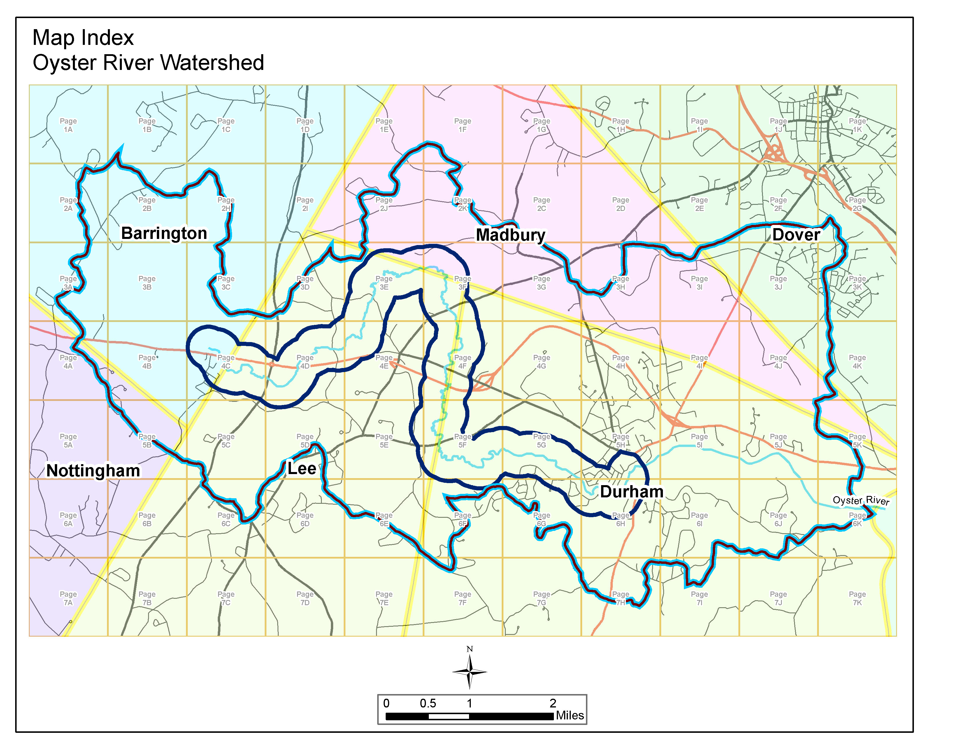
Using the Map Index below you can download detailed aerial view pdf files of the referenced rectangles. Each pdf is about 5MB.
Rows 3C-3H, 4C-4H, 5C-5H and 6C-6H are currently available for download.
Depending on the size of your monitor, you may have to use both horizontal and vertical scroll bars to view the entire watershed map.
Oyster River Local River Advisory Committee